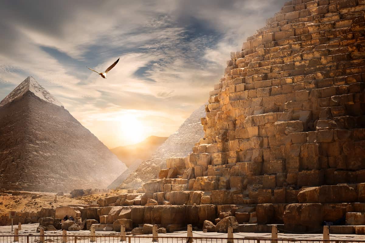
Sinai Peninsula Definition, Map, History, & Facts

The Sinai Peninsula northeast Egypt. The northern Red Sea between the Gulf of Suez and Aqaba comprises 23,500 sq mi (61,000 sq km). The Sinai Desert covers the northern two-thirds, while Mount Sinai dominates the south. The Israelites escaped Egypt on it. Egypt-Palestine trade crossed its north shore for millennia. From the second century CE through Islam’s ascendancy in the seventh century, it was part of the Roman Empire and Byzantine Empire. Before the 16th-century Ottoman conquest, Islamic dynasties governed it. It was ceded to Egypt at the end of World War I in 1918, controlled by Israel from 1966 to 1972, and fought in the Suez Crisis (1956), Six-Day War (1967), and Yom Kippur War (1973) before returning to Egypt. Arab-Israeli warfare.
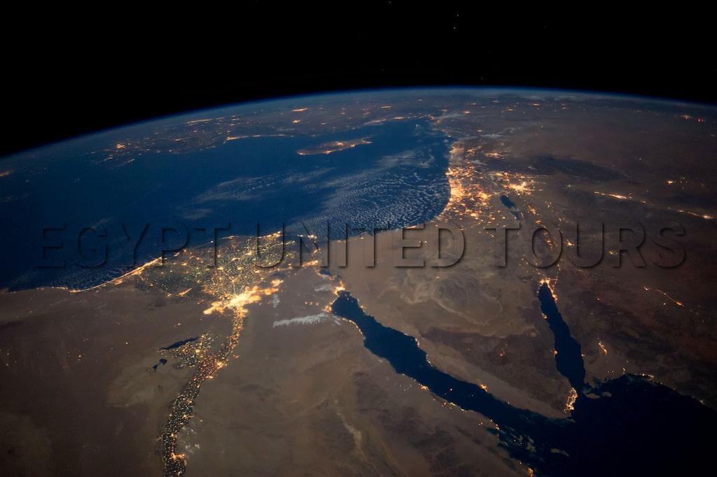
Sinai peninsula location
in fact, the Sinai Peninsula, in Arabic Shibh Jazirat Sina, is a triangular peninsula connecting Africa and Asia, covering 23,500 square miles (61,000 square km). The Sinai Desert, moreover, as the peninsula’s arid expanse is known, is separated from Egypt’s Eastern Desert by the Gulf of Suez and the Suez Canal. Still, it continues eastward into the Negev desert with little change in relief. They are generally considered to be geographically part of Asia.
The Sinai Peninsula is located in northeastern Egypt and borders Israel and the Gaza Strip to the east. The Sinai has been divided administratively into two governorates: Shamal Sina in the north and Janub Sina in the south. The peninsula was occupied by Israeli forces during the Six-Day War in June 1967 but returned to Egypt in 1982 under the terms of a 1979 peace treaty. And below you will find a map to explain the location

Sinai Peninsula Map
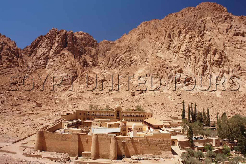
First, Early Christian hermits and ascetics lived in Sinai, notably in the steep south. Justinian I built the St. Catherine monastery on Mount Sinai’s lower slopes in 530 AD. The monastery was a pilgrimage site for various Christian communities in the Middle Ages. In 1517, the Ottoman Empire annexed the Sinai, and a Constantinople delegate administered it (now Istanbul). Travel to the Sinai became difficult after Egypt won independence from Ottoman rule in the early 19th century. Egypt ruled the Sinai Peninsula following World War I battles in Al-Arsh.
Egypt ruled Sinai until the Six-Day War in June 1967. In 1956, 1967, and 1973, the Giddi and Mitla bridges in the northeastern peninsula were the site of heavy fighting in every Israeli-Egyptian war from 1949 to 1973. Israeli-Arab wars The 1979 Egypt-Israel peace deal restored and demilitarized the Sinai Peninsula. The peninsula had many militant Islamic attacks afterward. Tourists were attacked in b (and elsewhere) in October 2004, Sharm el-Sheikh in July 2005, and Dhahab in April 2006. The 2011 Egyptian Uprising exacerbated a security vacuum, as civilians and Egyptian military personnel were attacked in the 2010s. On November 24, 2017, a Sufi mosque in Al-Rawah (near Al-Arsh) was struck in Egypt’s worst terrorist assault. This assault killed 300 worshippers.

Sinia Peninsula Name
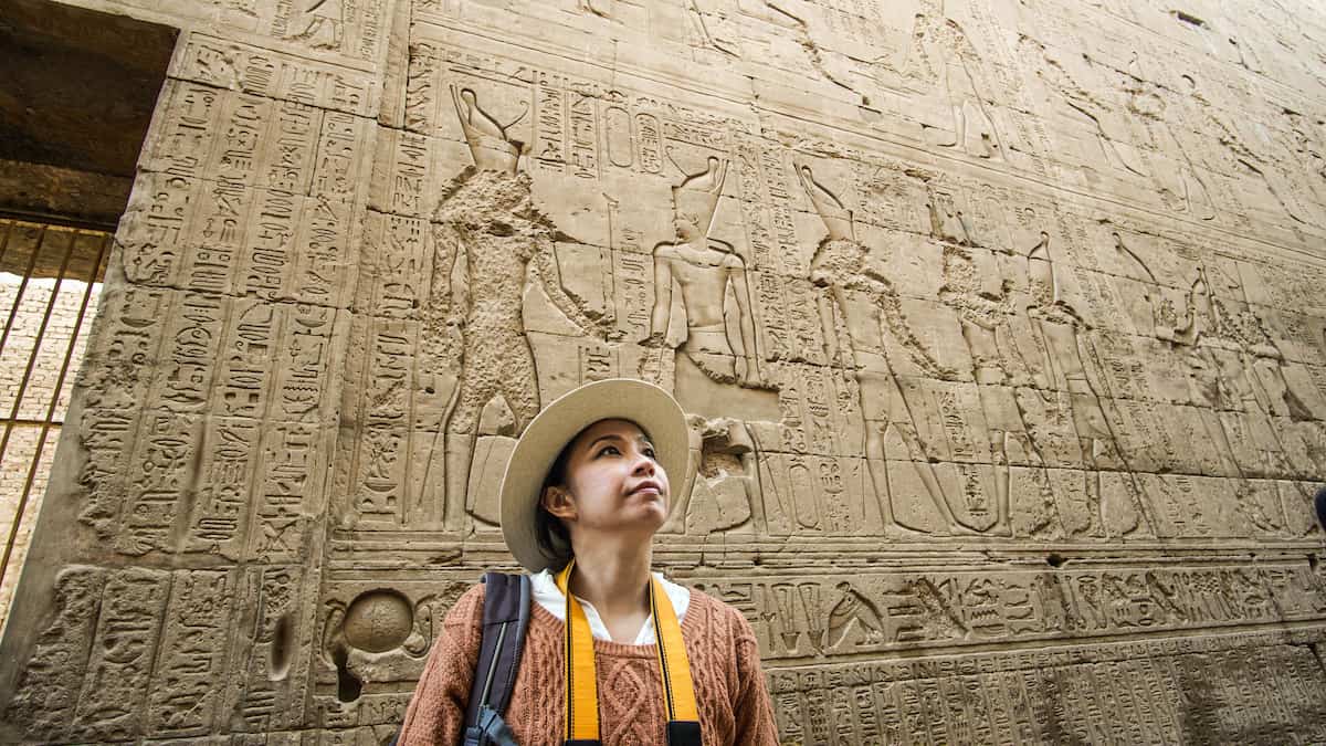
Arabia Petraea was the name of the area during the classical era. Due to the widespread belief that a mountain close to Saint Catherine’s Monastery is the Biblical Mount Sinai, the peninsula came to be known as Sinai in contemporary times. [2] One of the holiest sites in the Abrahamic religions is Mount Sinai.
Sinai Peninsula Geography
Accurate location
North and south, the Sinai Peninsula borders the Mediterranean and Red Seas. It borders the Gulf of Suez, the Suez Canal, the Gulf of Aqaba, and the Negev. Its biggest dimensions are 240 miles (385 km) north-south and 130 miles (210 km) east-west.
Sinai Has Two Primary Components.
The southern highlands include Mount Katherine (8,668 feet/2,642 meters), Umm Shmar (8,482 feet/2,585 meters), Al-Thab (7,997 feet/2,437 meters), and Mount Sinai (7,497 feet) (2,285 meters). The southern portion is mostly volcanic rocks, and steep, canyon-like wadis (seasonal watercourses) that fall into the Gulf of Suez or the Gulf of Aqaba abruptly cut through this topography. This skeleton mountain range rapidly rises from the Gulf of Aqaba on its eastern side and a tiny coastal plain divides it from the Gulf of Suez to the west. Two-thirds of Sinai is a huge plateau that falls from altitudes of more than 3,000 feet (900 meters) down to the Mediterranean and borders this mass on the north. The large Wadi Al-Arsh plain, island-like massifs, and huge coastal plains in the west and north with massive dunes define it.
The Sinai Desert
Three major drainage basins have evolved out of a significant ridge that spans along the southern border of the Sinai in a wide horseshoe curve. Wadi Al-Arsh, the master stream of the northern drainage basin, falls into the Mediterranean in Al-Arsh. Eastern (Gulf of Aqaba and Dead Sea) and western (Gulf of Suez) basins include several minor streams. The Sinai Desert receives over 1.6 million acre-feet (2 billion cubic meters) of water from local precipitation. As one-fourth of this water goes off and another quarter seeps into groundwater reserves, it has great water-saving potential.
Sinai’s climate is desert. Wadis, dunes, salinization, and eroding soil demonstrate Sinai’s aridity. Isolated terraces with heavy alluvial and lacustrine deposits suggest a wetter climate. In the northern, Mediterranean region of Sinai’s low topography, winter precipitation is 5 inches [125 mm], summer is dry and brutally hot, and spring and autumn feature dry southern khamsin winds and rare heavy showers. Due to severe topography, southern or the Red Sea climates differ. Winter ice covers the main summits. Southeast monsoons bring significant rain to the south in July. Summer nights are chilly. North Sinai breezes. The Red Sea has 60% relative humidity and the Mediterranean has 74%.
Wadi El-Arish
Furthermore, a horseshoe-shaped ridge along the Sinai’s southern border has formed three major drainage basins. Wadi Al-Arsh, the master stream of the northern drainage basin, falls into the Mediterranean in Al-Arsh. Eastern (Gulf of Aqaba and Dead Sea) and western (Gulf of Suez) basins include several minor streams. The Sinai Desert receives over 1.6 million acre-feet (2 billion cubic meters) of water from local precipitation. As one-fourth of this water goes off and another quarter seeps into groundwater reserves, it has great water-saving potential.
Moreover, for the recently watered northern coastal plain, the Sinai Desert’s vegetation is mostly transient, but perennial brush grows on the steep southern slopes and the plateau to the north. Succulents, halophytes, fodder, and medicinal plants grow on the subarid coastal plains. Ibex, gazelles, sand foxes, leopards, wildcats, jackals, hares, hedgehogs, and moles are infrequent. Falcons, eagles, quail, partridge, and grouse are native and seasonal.
Additionally, Sinai’s small population is largely concentrated in its northern and western edges, which have substantial petroleum and manganese industries and copious water. Besides farming, recovering land, and pastoralism, the settled population works in tourism, mining, fishing, petroleum, and pastoral industries. Industrialization and agriculture are attracting Bedouin tribes who migrate for water and grazing. The mountainous south’s St. Catherine’s Monastery houses Eastern Orthodox Christian monks.
Important to realize, Petroleum, discovered in 1910 in Mount Tanakah in western Sinai, is the peninsula’s main resource. Manganese and uranium ores may be extracted. Minerals, building stones, dolomite, sand, and gravel are available.
On the other hand, Land reclamation and irrigation using groundwater or Nile River water have reclaimed 100,000 acres of the northern coastal plain. Barley, fruits, market vegetables, dates, olives, and wood trees are cultivated. Date palm palms dot the peninsula, and some Bedouin people still herd animals.
History Of Sinai
Ancient Egypt
Additionally, in Sinai, the Egyptians mined turquoise as early as the First Dynasty. These two areas are today known by their Egyptian Arabic names, Wadi Magharah, and Serabit El Khadim. Over thousands of years, the mines only saw seasonal or occasional use. Attempts to profit from the deposits in the modern era have failed. These mines may be the earliest ones in history. In western Sinai, in the fortification known as Tjaru, Egyptian offenders were exiled. Through northern Sinai, the Way of Horus led to ancient Canaan.

Roman and Byzantine Periods
Important to realize, During the Ptolemaic era in Egypt, the area around what is now called Arish was known as Rhinocorura (Greek for “Cut-off Noses”). With the death of the last Nabatean king, Rabbel II Soter, in 106, Roman Emperor Trajan invaded the country on 22 March of that year and quickly took control. This victory gave the Roman Empire control of all coastlines in the Mediterranean. Arabia Petraea, which included the Sinai Peninsula, was a province of the Roman Empire.
in addition, from 527 and 565, Emperor Justinian had Saint Catherine’s Monastery built at Mount Sinai’s base. In the sixth century, the Sinai Peninsula was annexed by the province of Palaestina Salutaris.
British Control
By nominally handing up the sovereignty of Sinai to the Egyptian Khedive in 1906, the Ottoman Porte effectively ceded control of the peninsula to the British Empire, which had conquered and mostly ruled Egypt since the 1882 Anglo-Egyptian War. From Rafah on the Mediterranean coast to Taba on the Gulf of Aqaba, the British-imposed boundary follows a nearly straight path. Since then, Egypt’s eastern border has followed this line.
Israeli invasions and occupation
Egypt seized the Suez Canal in 1956. After this, Israeli ships were banned from the Canal. Egyptian national seas on the eastern side of the peninsula have obstructed Israeli shipping channels to and from Eilat. In October 1956, Israeli soldiers entered Sinai with Britain and French support in the Tripartite Aggression (who wanted to undo the nationalization and reclaim control of the Suez Canal). Israel left Sinai in March 1957 under US and Soviet pressure. After it, UNEF was dispatched to the Sinai Peninsula to maintain calm.
UNEF And Reoccuping of Sinai
After ordering the UNEF out, Egypt reoccupied Sinai forcefully on 16 May 1967. Secretary-General U Thant concurred and ordered the departure without consulting the Security Council. After the Six-Day War, Israel seized Egypt (including the Sinai Peninsula and Gaza Strip), Jordan (including East Jerusalem), and Syria (the Golan Heights). Israel’s conquest east of the Suez Canal closed it. Israel is attempting large-scale colonization there.
Egypt began the War of Attrition (1967–70) when Israel seized the Sinai Peninsula to expel Israel. Throughout the conflict, the Suez Canal Zone saw skirmishes and major engagements. Israeli bombing of Port Said, Ismailia, and Suez on the west bank of the canal killed many civilians and forced 700,000[25] Egyptian internal refugees to flee. The front lines didn’t change before 1970.
October War
Egypt initiated Operation Badr to reclaim the Sinai and Syria began Operation Golan Heights on October 6, 1973, starting the Yom Kippur War. Citation required (known in Egypt and much of Europe as the October War). Egyptian engineers built pontoon bridges to cross the Suez Canal and assaulted Israel’s Bar-Lev Line on the east side of the canal. In the last stages of the fight, Israeli soldiers crossed the southern Suez Canal, isolating the Egyptian 3rd Army and seizing much of the west bank. Egypt controlled much of the east bank of the Suez Canal. A ceasefire ended the war. Egypt allowed Israeli ships to use the Suez Canal after the conflict and Sinai Disengagement Agreements. Anwar Sadat led the canal’s maiden caravan in 1975.

1979–1982 Israeli Withdrawal
In 1979, Israel agreed to depart the Sinai Peninsula. Israeli soldiers left gradually in 1982. The departure destroyed most Israeli settlements, including Yamit in northeastern Sinai. The Treaty limits Egyptian armed forces in the Sinai Peninsula and lets the Multinational Force and Observers observe them.